Photo: David Luecke/AllTrails
The hike to the summit of North Vancouver’s Mount Seymour is a summer classic. It’s a moderately challenging route through the forest and over lots of tricky rocks and roots. But the sweaty climb to get there is worth it thanks to spectacular views of the city and surrounding mountains from all three peaks.
Safety First: AdventureSmart recommends bringing a backpack with essential safety and first aid gear on every hike. Check the forecast and pack extra clothing for the weather. Leave a trip plan so someone knows where you are going and when you will be back.
Trail Stats: Moderate, 9km round trip, 450m elevation gain, 5 hours, dogs allowed on leash
Getting There: Take the Mount Seymour Parkway exit from Highway 1 in North Vancouver. At Parkgate Village Mall, turn left onto Mount Seymour Road. Follow the road as it switchbacks uphill. Park at the end of the road in the ski area parking lot.
The Trail: The route to the summit of Mount Seymour is fairly straightforward, but the trail does cross the ski runs several times, which can be confusing. Pay attention to the markers and bring a copy of the park map to stay on track.
This year the snow is lingering a bit later in the season, but it is melting fast. If you tackle this hike in early July, be prepared to encounter snow on the upper reaches of the mountain. Hiking poles and microspikes or boots with good grip can be useful on the steep sections if it’s snowy.
Find the trailhead at the far end of the parking lot next to a large info sign. The first few meters of the route follow a gravel ski area access road. Ignore a left turn onto the Dog Mountain Trail, then turn left almost immediately after onto the Mount Seymour Trail.
The path heads uphill into the trees, crossing several small bridges. Ignore side trails branching to the left. After about 1km, the trail emerges from the forest into an open area and heads up a small slope to a gravel road (a ski run in the winter). Turn left and follow the road for a few minutes. Keep left when another road goes uphill to the right.
A minute later, leave the road to follow the trail heading downhill towards a small pond. Pass the pond, then go uphill again to meet another gravel road. Follow the road as it climbs through a more open area, then turns into a trail again.
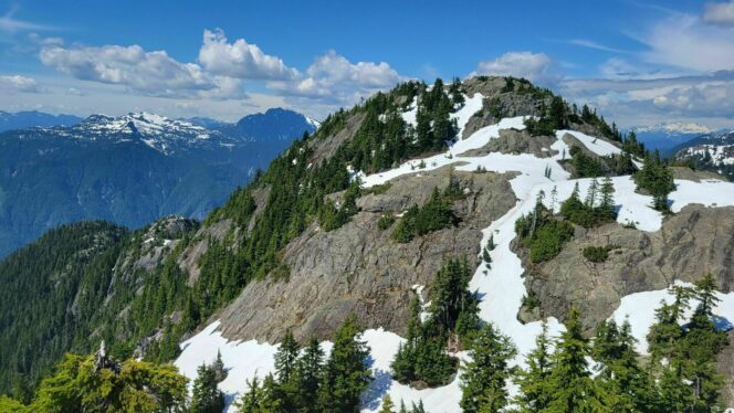
The route travels past rocky outcrops, then begins an undulating traverse around the southeastern flank of the mountain. Reach a junction with the Elsay Lake Trail in a small saddle. From here the real climbing begins. Turn left and begin the ascent. This part of the route is technical with lots of rocks and roots, so take your time. As the grade begins to lessen, you will emerge into an open subalpine area with a small pond.
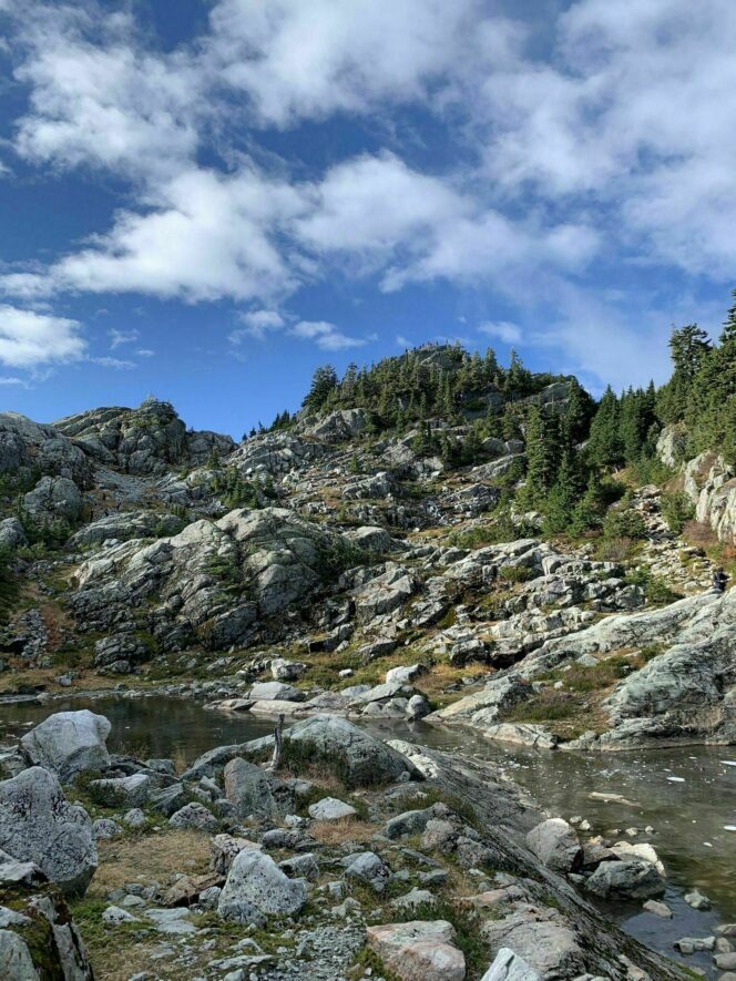
Photo: Kelen B Maria/All Trails
Stay on the trail around the pond and continue uphill to another junction. Turn left to clamber across the rocks to the viewpoint at Mount Seymour’s First Peak, also known as Pump Peak. You can gaze down to Vancouver and east up the Fraser Valley.
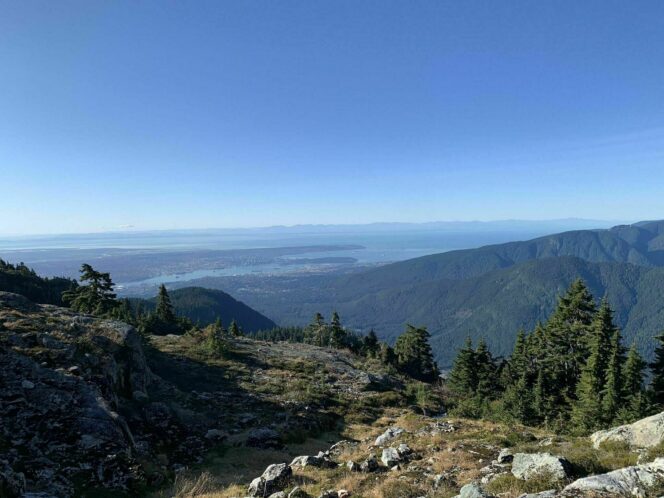
Photo: Megan M/All Trails
If you have more energy, carry on to visit Mount Seymour’s other two summits. On the main trail, watch for orange paint on rocks to guide you through a low point, then uphill again towards Second Peak. This peak is also known as Tim Jones Peak, after the late leader of North Shore Rescue. Follow a short side trail to the summit for great views of the mountains to the north.
To continue to the third and highest peak, carefully descend off Tim Jones Peak and follow the narrow trail through a notch. Take care here on one exposed portion before making the final climb to the summit. Congratulations! You have reached the 1449m-high peak of Mount Seymour. Soak up the views, then retrace your steps to your car.